My Air BnB hosts gave me a lovely breakfast, then I set off on my day’s journey – around the scenic and remote East Cape. I had been warned that these roads would be like none I had ever encountered, and man, was that true. There were times that I was literally on the edge of a cliff driving, wondering whose bright idea this trip was – especially when I met logging trucks that seemed too big for the road – or camper vans driven by less than skilled drivers – however, as is always the case, the destination was indeed worth the journey.
I left Gisborne, and then headed out to Tolaga Bay Wharf, which is the home of the longest pier in New Zealand. The 600 meter pier is completely accessible to the public, and I enjoyed my scenic view walking down the pier. It is not barriered at the end – so you really are standing on the edge above the ocean. The pier also has a fascinating story about how they saved it.


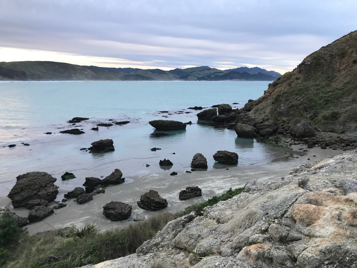
After Tolaga Bay, I headed to Anaura Bay – and I encountered my first closed road, due to a slip.
I parked the car, then walked around to get a glimpse of the beautiful, secluded bay, before turning back around to continue my adventure.


My next stop was a little pull off the road to enjoy the rolling Pacific at Tokomaru Bay.


I then ventured to Waipiro and had a little picnic in Ruatoria, both of which were very sleepy towns.


Leaving Ruatoria, I had my first of several livestock encounters for the day, as a flock of sheep escaped – and decided that they wanted to hang out in the street. I had visions of trying to explain why I had a sheep imprints on my rental car as I tried to make it through the mob.


Once safely on my way, I headed the distance to the TikiTiki Church. It is actually St. Mary’s Anglican Church, and is the best example of the meeting of the Maori and European Cultures, in a beautiful space. It is one of the most unique places of worship I have ever been in.
I ventured down the road a bit to see another church (outside only), and encountered one of the many unique New Zealand road signs.


My next stop was the East Cape – home of the East Cape lighthouse, and the furthest east point on the North Island. Due to rains, the road was more treacherous than usual, and was quite slow going. I passed through cow fields – where cows literally were grazing on the beach, and I finally reached my destination – the walkway to the lighthouse, where they certainly want you to know the access isn’t easy.


As I started the journey, I realized that I was going to be racing the sun – but I didn’t come all this way to just spy the lighthouse from the bottom, so I continued my journey – folks coming down warned me that some of the steps were slippery – and man were they right – also, someone had a sense of humor, and engraved odd numbers on the steps to trick you, so a couple of ladies and I had a laugh about that!
What was interesting is that some of the “steps” you actually had to climb – well if you are short like me, that is – because the steps were higher than my knee!
But, I kept keeping on the journey – enjoying the views, and minding the setting sun.


Once I was at the top, I was rewarded with some stunning views – it was worth every step, slip and climb.


I stayed up there as long as I could, but realized that back in the bush it was going to be awful dark, so I headed back down, and it was quite treacherous going down, as I hadn’t thought to grab my head lamp from the car, and was navigating using the light on my phone, but I made it down, and to my car before I lost all light.
I then journeyed back out the East Cape road, very slowly after dark – and continued my livestock encounters.


Those cows that had been on the beach? All decided to be on the road – and they were stubborn. . .but eventually they cleared the road as did the seals, random pests (possums and rabbits) and birds, and I made it to my lodging for the night without hitting anything. The “resort” I was booked in was the closest lodging to the sea I have ever seen – and continuing the slippery wood theme of today, the stairs to check-in were steep – and I have a nice skinned knee to prove it, but when you see my view in the morning, I think you will agree it is worth a little skinned knee and a bruise or two (and the quirky owner – who wanted to charge me for a blanket – thankfully I had a sleeping bag in the car!).